The 1472 cadastre
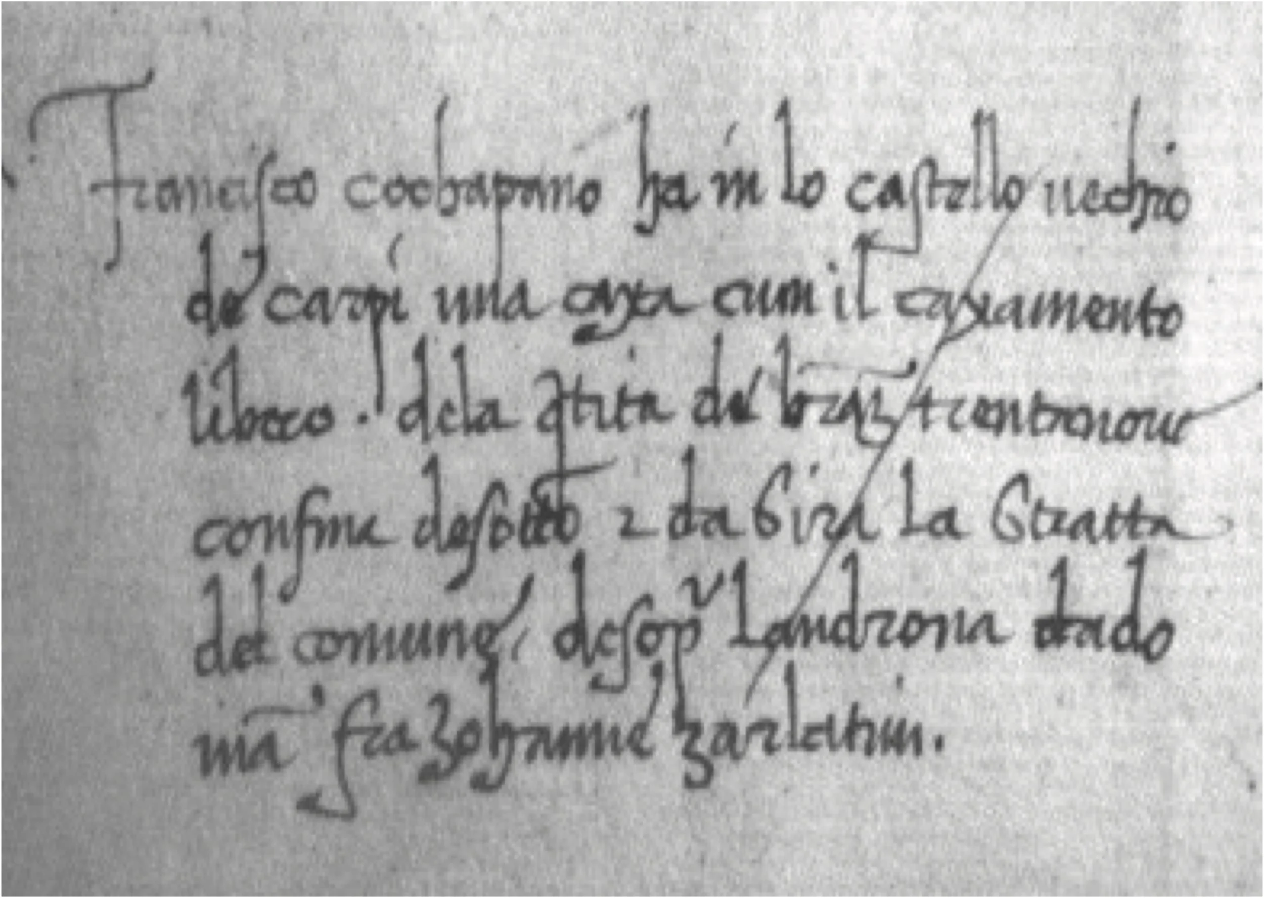
The Text
Francisco Cochapano ha in lo castello vechio de carpi una caxa cum il caxamento libero de la quantità de braza trentanove confina de sotto e da sira la stratta del comune, de sopra l’androna da doman fra Zohanne Zarlatini
The Translation
Francesco Coccapani owns a house in the old castle of Carpi, with an open plot of land and a street frontage measuring 39 braccia (20.46 metres). It borders the public road to the north and west, the androna to the south, and Friar Giovanni Zarlatini to the east.
* The androna is a small drainage channel running behind the buildings, at the end of the courtyard, forming part of the system for rainwater runoff.
The document records approximately nine hundred properties. For each one, it indicates the owner, the width of the street frontage, and the adjoining properties. At that time, streets did not have names as they do today, and cadastral records were organized by the owner’s name rather than by location within the city. By comparing adjoining properties and the orientation of street boundaries, it was possible to link together a large number of properties and reconstruct rows of buildings.
Comparison with modern maps then made it possible to determine their exact location, thereby giving shape to the urban structure of fifteenth-century Carpi.
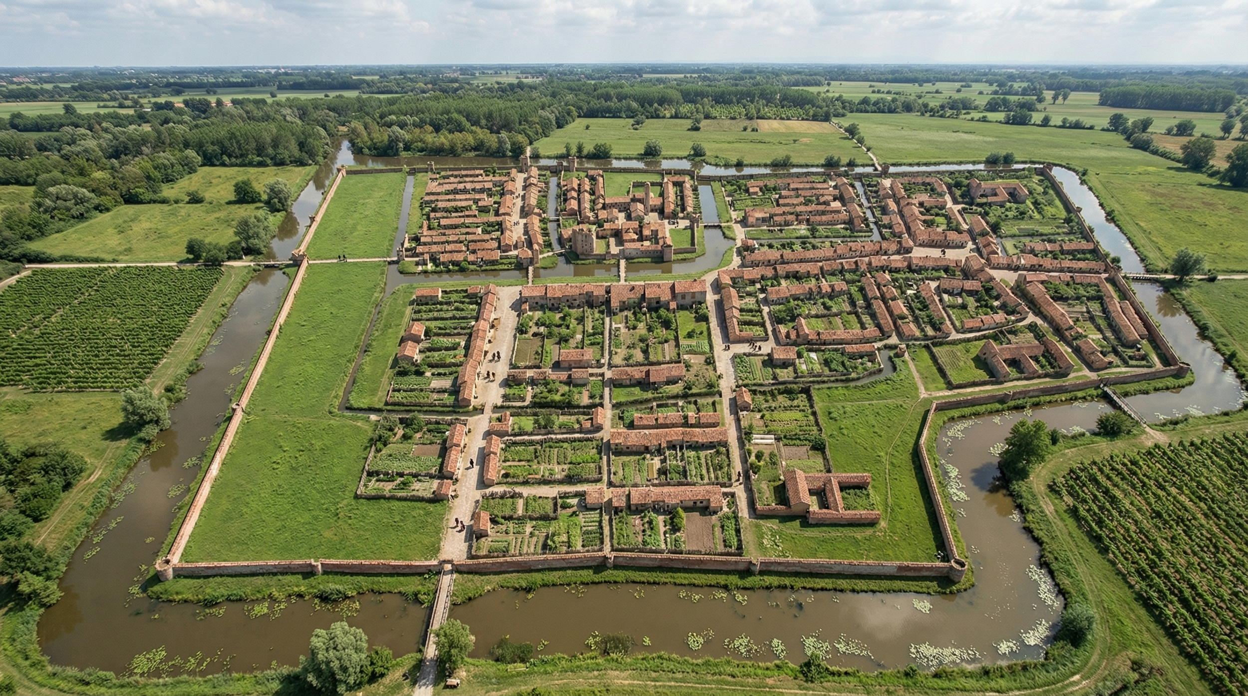
Carpi in 1472, reconstructed from cadastral data
The Method Used
via san Francesco, north side
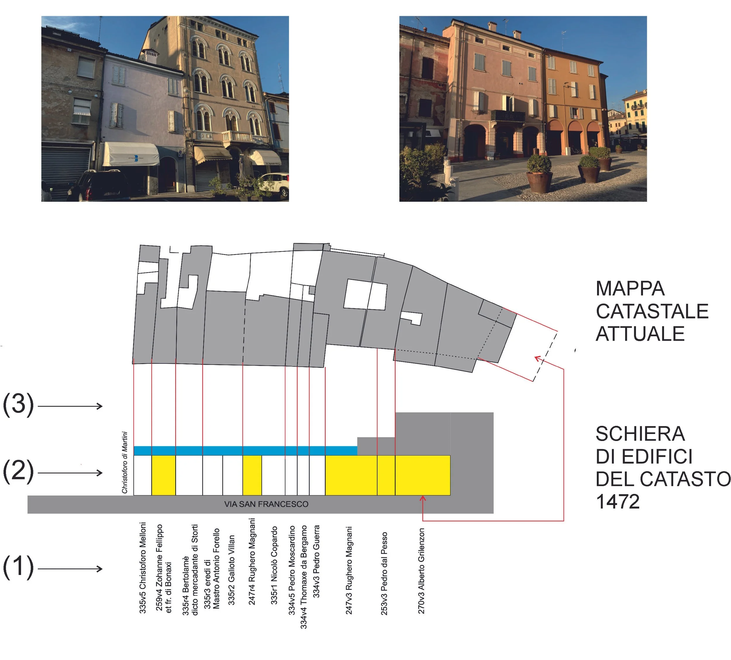
Current cadastral map
Row of buildings from the 1472 cadastral record
1 – Identification of the sequence of properties by comparing boundaries and orientations.
(The code indicates the position of the entry in the document. For example, Christoforo Melloni is recorded on page 335, on the back (verso), in the fifth position from the top.)
2 – Drawing, at a scale of 1:1000, of the building rows, based on the measurements recorded in the cadastral document (one Carpi braccio corresponds to 0.5247 metres).
3 – Comparison with modern maps to identify the correspondence between property boundaries and determine the exact position of the building row. In this example, 11 correspondences have been identified (red lines). Only two boundaries do not match (due to later subdivisions or reconstructions), so the location of the row can be considered accurate.
Archaeology of Measurement
Measuring means establishing a relationship between something already known (the unit of reference) and something new to be understood (what we want to measure). When this criterion becomes socially shared — when everyone agrees to use the same unit of reference — measurement also becomes a system of communication, a language understood across the entire social context.
Drawing the map of a city is an activity grounded in the measurement of each of its components: streets, building façades, green areas, and more. What is particularly relevant in the case of historic cities is that, even if an ancient building is demolished or falls into ruin, having measured it allows us to reconstruct it — or at least to imagine its form, even when it no longer exists.
There is, however, another important aspect: a city is made up of people grouped together according to certain patterns. Houses are arranged in rows along streets, yet, despite their proximity, they have different histories. Over time, some are rebuilt or extended vertically while others are not. Materials and forms may change, but dimensions often remain unchanged, because each building is constrained by its boundaries.
We therefore have a strong possibility of rediscovering the urban form of past cities simply by measuring their dimensions, without relying on the material fabric of the buildings that exist today.
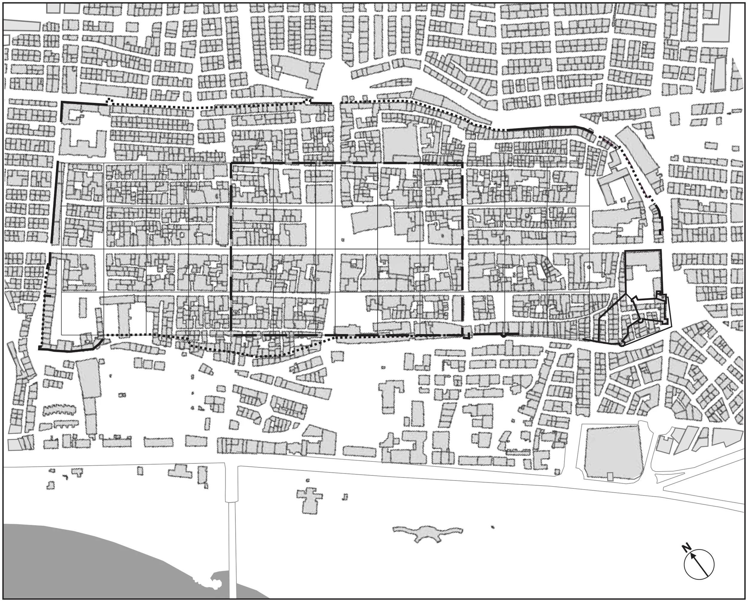
Urban structure at the time of Gela’s founding
geometries
The use of geometric figures, and their combination into more complex forms, has been a method employed since antiquity to maintain control over the quality of the result during the progress of construction.
The identification of these schemes helps to reveal the original design and, by contrast, the variations that have occurred over time.
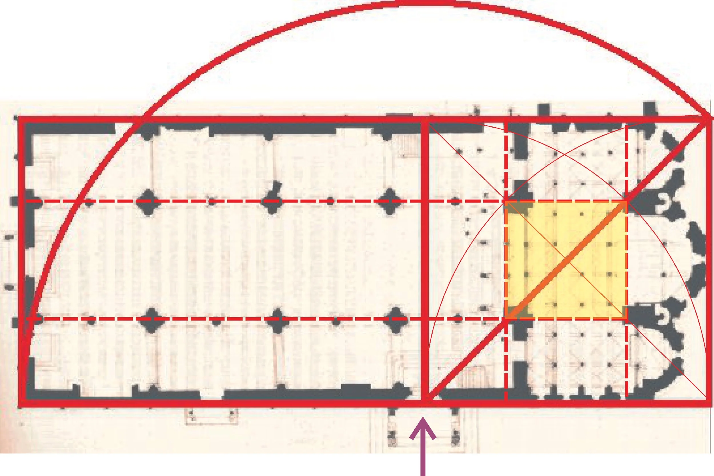
Modena Cathedral. From the square of the presbytery, the rotation of the diagonal and the side generates the entire architectural layout of the building.
Precision and accuracy
Measurement: a historical path toward precision
Over the centuries, the activity of measuring has extended to an increasingly wide range of objects and phenomena, and increasingly precise criteria have been developed.
This pursuit of precision has been driven mainly by two factors:
the need to describe (and evaluate) increasingly complex realities;
the need to reduce error.
These factors have evolved alongside scientific and technological discoveries, which in turn have made it possible to conceptualize and develop increasingly sophisticated instruments.
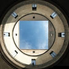
Courtyard of the House of Mantegna in Mantua. From the center of the courtyard, looking upward, the circular profile of the first level coincides with the square profile of the second, creating a regular geometric form. Notice also the position of the windows.
the 2-1 rectangle
Why do so many ancient agricultural measures take the form of a 1-2 rectangle, composed of two adjacent squares?
A possible explanation arises from a very simple geometric structure: the relationship between a semicircle and its chord.
The semicircle is an ancient form, linked to the cycle of the sun: it rises, traces its arc, and sets.
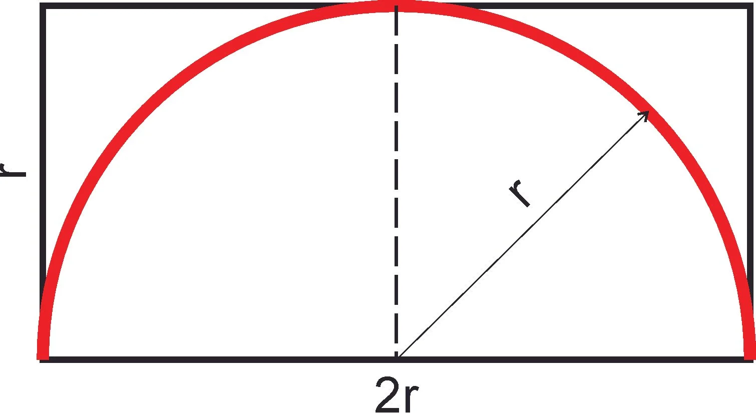
Let us imagine a semicircle resting on a horizontal line (its chord). In this figure, two fundamental directions immediately appear: the width, given by the diameter, and the maximum height reached by the arc. The relationship between these two dimensions is precise: the width is twice the height. In other words, the internal ratio of the semicircle is 1-2.
If one wishes to transform this curved form into something measurable and divisible — for example, to organize a plot of land — it is natural to move toward a rectilinear shape that preserves this proportion. The simplest solution is a rectangle with sides in a 1-2 ratio, that is, composed of two equal squares placed side by side.
This rectangle has very useful properties: it maintains a clear direction (it is longer than it is wide), yet remains simple to divide and to replicate. For this reason, it represents an excellent “module” for organizing space, especially in agricultural contexts, where regular, divisible, and easily alignable forms are required.
From this, one can understand why, in different historical contexts, units of land measurement often share similar proportions: not necessarily because they all derive from a common cultural origin, but because they converge toward a simple and efficient geometric solution.
In summary, the 1-2 rectangle can be seen as the most immediate practical translation of a fundamental geometric relationship already present in the semicircle: that between base and height.
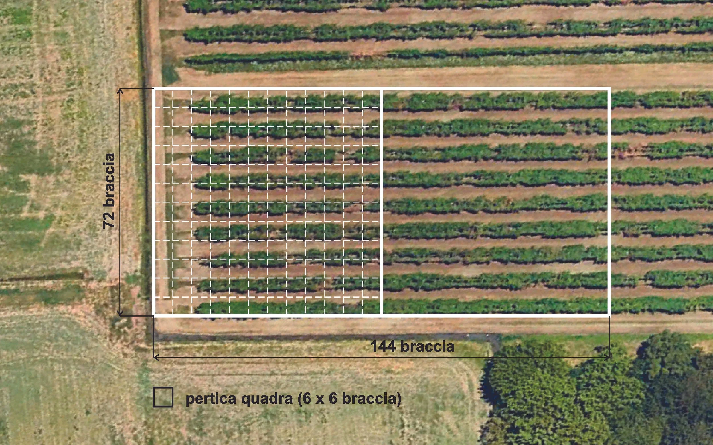
Carpi biolca = 2,854.42 square metres, corresponding to an area of 72 × 144 braccia
(one surveyor’s braccio = 0.5247 metres)